Scientist unveils the volcanic history of Karioi
While many may not immediately associate Raglan with volcanic activity, Karioi has played a central role in shaping the region’s rich and storied history. For Oliver McLeod, a dedicated geological researcher currently working for the Waikato Regional Council, Karioi is much more than a natural landmark—this ancestral maunga is a window into the past, blending scientific exploration with the deep cultural heritage and mātauranga of the area.
Oliver’s journey into geology began in his childhood, growing up on Kawau Island in the Hauraki Gulf and Auckland, where he could view Rangitoto, Mt Albert, and Orakei Basin. As a young boy, he would climb to the highest points near him to sit and draw maps of the terrain and natural landscape around him. It was an early hint of the path he would later take, leading him to study geology at Otago University.
A pivotal moment in his career came while spending time with his wife’s family in Mexico, who coincidentally lived on a mountain that happened to be a scoria cone, similar to those found in Auckland. Oliver had a significant dream urging him to return to Aotearoa and research the maunga Pirongia. This dream led him to the University of Waikato. Oliver’s PhD research, supervised by Dr Adrian Pittari—a volcanologist at Waikato, focused on unravelling the volcanic history of Pirongia, one of the North Island’s largest basaltic volcanoes. During this time, Oliver met Roger Briggs, a long-time faculty member of the University of Waikato Earth Sciences department, who taught Oliver much of what he knows about Pirongia and Karioi. Roger is well known for mentoring generations of students who have gone on to have geological careers. Oliver’s PhD research resulted in the creation of a detailed geological map of Pirongia and the publication of his book, Geology of the Pirongia Volcano. Following this project, his interest naturally shifted to Karioi, Pirongia’s sister maunga.
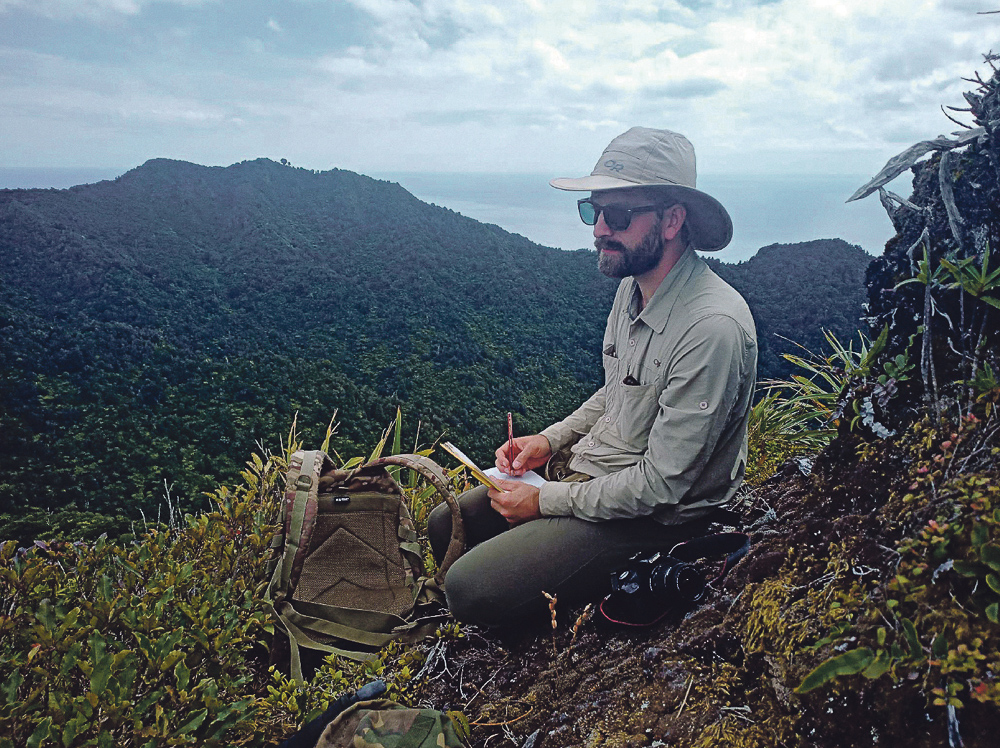
To uncover the geological secrets beneath Karioi’s surface, Oliver spent many months from 2020 and early 2022 hiking up and around the mountain, equipped with a backpack, his hammer, and GPS. He collected hundreds of rock samples, some of which were sent to Japan for argon dating to determine the ages of Karioi’s oldest and youngest lava flows—a first for this area. Oliver’s colleague Chris Conway at the Geological Survey of Japan, known for his work mapping Mt Ruapehu during his PhD, carried out this testing and also connected Oliver to his mentor Osamu Ishizuka, who would become a co-author of the book about Karioi.
Oliver’s findings reveal a complex history of volcanic activity that lasted around 300,000 years, during which Karioi evolved from explosive ash rings and scoria cones into a large stratovolcano. However, for Oliver, the story of Karioi is not just one of volcanic activity—it is also a story of whakapapa and the deep connection between the land and the people who have lived beside it for generations. “Studying Karioi as pure science leaves many missing pieces,” he reflects. “The full story of Karioi is a story of whakapapa, extending from the deep geological past to the present day and into the future.”
His work led him to engage deeply with the local community, learning from those who have lived in the shadow of Karioi for generations. As Oliver’s research progressed, it became clear that the geological map he was creating would also tell the story of the people who have called Karioi home. Kaumātua shared place names preserved in oral history for centuries. Intertwining geological and cultural landscapes, these names are now included in the geological map. The map highlights several ancient pā sites, showing how the geology of the land influenced where people lived, gardened, and defended themselves. It’s a powerful reminder that the history of a place is not just written in the rocks but also in the lives of those who have lived there.
Oliver McLeod’s work on Mt Karioi is a remarkable fusion of science and storytelling, capturing the essence of a landscape that has shaped, and been shaped by, the people who live on it. As Raglan’s famous surf breaks continue to be sculpted by ancient lava flows, Oliver’s map and accompanying research provide a valuable resource for understanding the dynamic forces that have shaped this unique corner of Aotearoa. More importantly, his work reminds us of the deep connections between people and the land, and the stories that bind them together.
The results of Oliver’s meticulous research have culminated in a detailed geological map of Karioi and the surrounding landscape. Alongside the map, which is presented on an intricately detailed base map created with newly released LiDAR technology, Oliver has published his findings in a new book titled Geology of Karioi Volcano, Aotearoa New Zealand.
To celebrate the culmination of this significant work, Oliver has partnered with Raglan Naturally for the official book launch. As well as sharing some of his research findings, Oliver will be joined by a panel of local kaumātua with whom he collaborated closely throughout the project. After the sharing of kai, an exhibition of Oliver’s research will be opened at the Raglan Old School Arts Centre (running from 7th-14th September).
Oliver’s book will also be available for purchase at the launch, as well as high-quality printed versions of the geological maps of both Karioi and Pirongia. Framed, they are a work of art to treasure and enjoy.
Event Details: Book Launch of Geology of Karioi Volcano & Exhibition Opening
Date: Saturday, 7th September
Time: 11am
Venue: Stewart St Hall and Raglan Old Arts Centre


